Understanding commuting based on postal code analysis
The interactive Mobility Scan provides insight into your organization’s total commuting based on the postal codes of your employees’ home addresses and work locations. In both the current and potential situation. You can see where your employees live, how they (can) travel, and what the impact is on costs, travel times, CO2 emissions, parking spaces, and vitality.
The scan is widely applicable and is used by all kinds of employers; from manufacturing companies, service providers, and government agencies to healthcare institutions and education. Within these organizations, HR staff, managers, director-owners, works council members and other stakeholders use the scan to formulate scenarios and discover their impact.
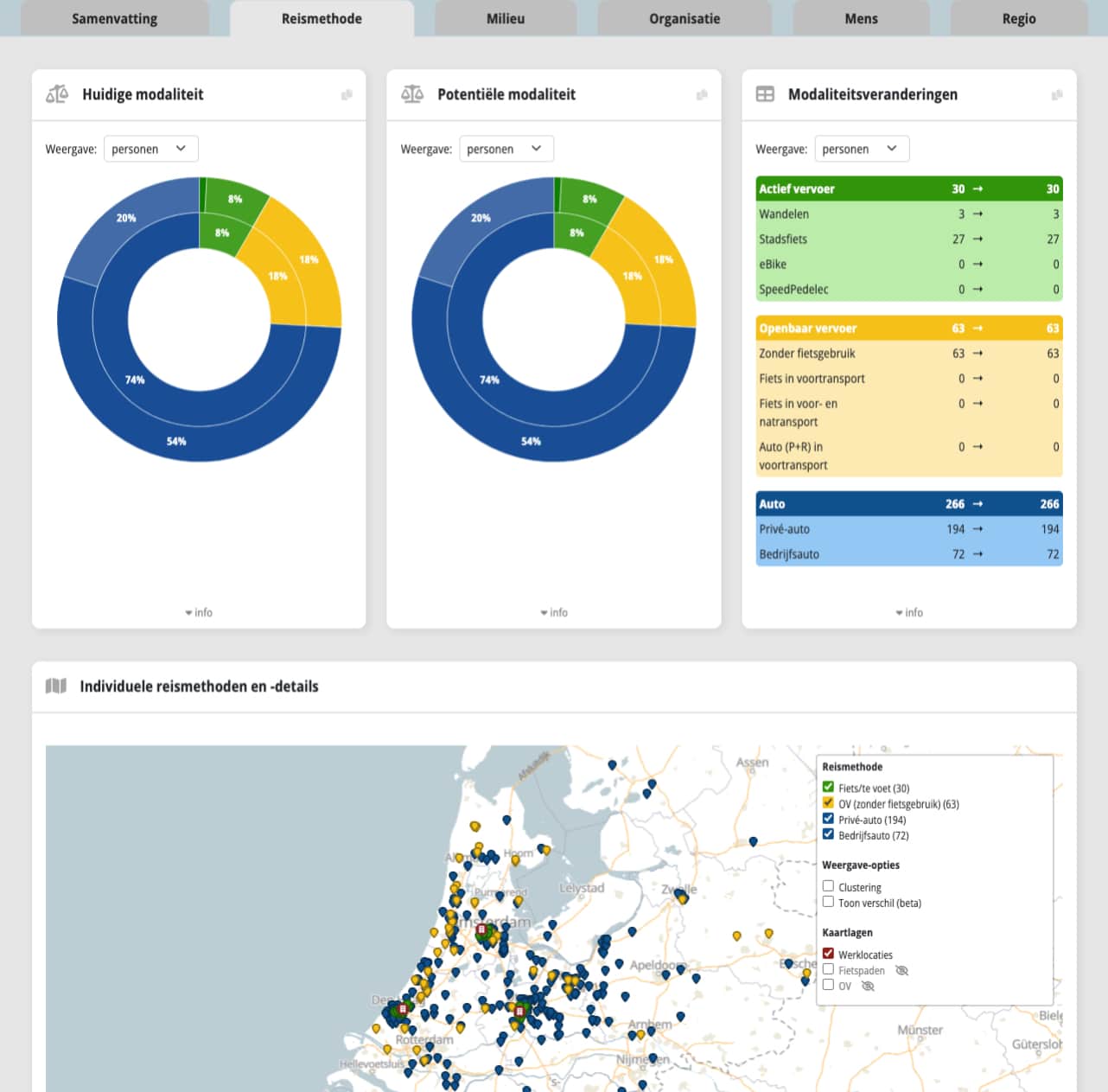
You establish a foundation based on accurate and current data. You provide the postal codes of the residential addresses, the scan does the rest. Discover the transformational potential of your organization: How many people can travel by public transport, bicycle or combination? What is the role of P+R facilities? And what is their impact on parking spaces or CO2 targets, for example? You control it yourself and can ‘play’ with other mobility policies. Discover the opportunities for improvement in commuting for your organization.